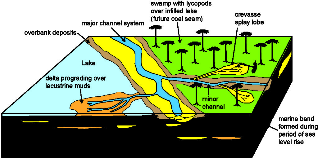
The block diagram below illustrates a schematic model of the depositional systems thought to be prevalent during the Namurian and Westphalian of the Glasgow area.
Large rivers in raised channels with levees (like the Mississippi) occasionally broke their banks flooding low-lying swamps and lagoons (similar to what happened when Hurricane Katrina hit New Orleans).
These floods were responsible for knocking over and killing the trees and subsequently filling their hollow stumps with sand.