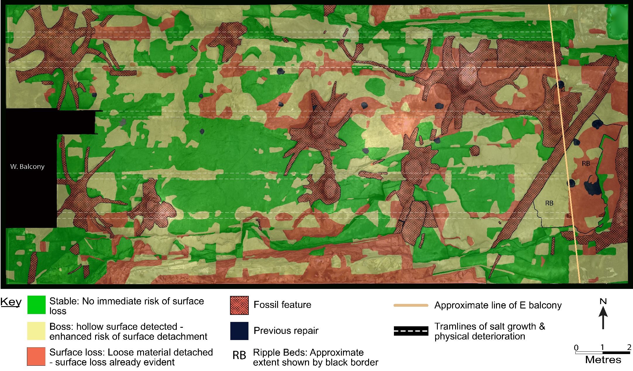
Photographs of water ingress and salt deposition around tree stumps and along tramlines under roof beams. Detailed mapping of these areas on the laserscan base has been completed.

‘Tramlines’ of condensation drips

Salts causing surface breakup around dripline next to stump#1

Stump#1 dripline with salt deposits and surface deterioration