The map below illustrates the palaeogeography for the Carboniferous about 300 million years ago.
The boxed area highlights the location of the British Isles close to the equator.
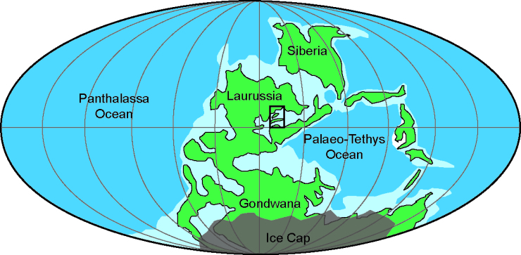
The continents of Gondwana and Laurussia are in the process of colliding, eventually resulting in the creation of the supercontinent Pangea.
The southern part of Gondwana was covered in extensive ice sheets which had a major effect on the sea levels at this time.